
In autumn, the settlements in the Poiana Ruscă Mountains, in western Romania, become favorite destinations for hiking enthusiasts looking for the beauty of nature and accessible and picturesque places to see in Romania. “The Truth” presents some of the spectacular tourist routes.
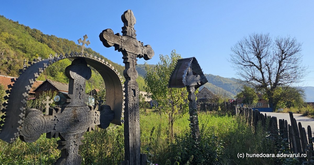
Prayers from the Forest Land. Photo by Daniel Guță. TRUTH
The Poiana Ruscă Mountains appear, on the geographical map of Romania, as a bridge between the Apuseni Mountains and the Southern Carpathians, which stretch in the west of Romania, across the counties of Hunedoara, Timiș and Caraș-Severin.
The mountains have an area of more than 2,500 square kilometers, mostly covered with forests, and the highest of their peaks rise up to 1,400 meters.
Although their relief includes hills and mountain plateaus of 800-900 meters, the unfavorable climate for agriculture has meant that, over time, the human settlements in the Poiana Ruscă Mountains have small populations, a maximum of a few hundred inhabitants.
The archaic villages and the “green gold”, disappeared
Only at the beginning of the 20th century the villages huddled on hilltops or lined up in steep valleys were somewhat more crowded – even overpopulated, according to the standards of the time, when the population was related to the area of arable land allocated to each household.
Then, people migrated to these places, along with the development of mining, the mountains being rich in natural resources.
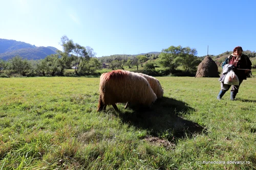
Image 1/30:
Lunca Cernii Photo Daniel Guță THE TRUTH (107) JPG
In addition to the “green gold” of the forest, which seemed inexhaustible, the iron deposits attracted many families to the land occupied until then by forest dwellers, the inhabitants of the oldest villages in the Poiana Ruscă Mountains.
The mining operations were closed by the 2000s, and the archaic villages of the foresters gradually depopulated. The locals went down to the nearest towns at the foot of the mountains – Deva, Lugoj, Hunedoara and Caransebeș – and the forests gradually covered the former pastures and agricultural lands.
In recent years, several roads, difficult to access in the past because of the steep slopes and their arrangement of earth and stone, have been modernized. With them, the mountain villages came out of isolation, and tourists began to discover them (video – the new road to Poiana Răchitelii).
In autumn, these places in Hunedoara, Caraș-Severin and Timiș can become ideal destinations for hiking enthusiasts.
Stories until dusk
Several thousand people live in the villages located on the tops of the Poiana Ruscă Mountains. The settlements remain lively until winter arrives, when some families move to the more comfortable dwellings in the cities.
A century ago, the seasonal migration of mountain locals was reversed. Foresters or mountaineers – as the locals are called – went down to the plains during the summer to work in the cities or on the agricultural lands, and in the winter they stayed in their villages, then isolated.
“Until the frost starts, tourists find most of the locals in the villages, so they can visit their households, listen to stories with them, find all kinds of fruits: apples, nuts, berries, pumpkins , all raised in the will of nature. It’s a good time to visit foresters’ villages” says Maria, a local from the village of Batrâna in Hunedoara (video).
Around the picturesque mountain villages, with over a century old households on which the patina of time has settled, the forests stretch over thousands of hectares, and seen from the plain roads show a spectacular autumn color.
“As winter approaches, the leaves of the woods begin to turn pale, rust and fall, and the meadows take on a more earthy color. Then the wind starts to blow harder and the cold feels stronger and the days get shorter. So now is the most favorable time for trips to us”, believes another villager from Batrâna.
The tourist village from over 1,000 meters
One of the most popular routes in the Poiana Ruscă Mountains starts from Corvinilor Castle and goes up to the village of Poiana Răchitelii (video), located at over 1,000 meters, from where it descends towards the Mureșului Valley and Deva.
The circuit has a length of about 100 kilometers and only from this summer, after the rehabilitation of the ten kilometers of road (DJ 708 D) between Poiana Răchițelii-Feregi, it can be fully traveled by car.
Drivers starting from Hunedoara on Valea Zlaștiului can go up to the Poiana Ruscă Mountains on the 40-kilometer Hunedoara-Cerbăl-Poiana Răchitelii road, modernized in recent years.
On the route you can find the archaic villages of the foresters – Arănieș, Ulm, Cerbăl, Socet and Poiana Răchițelii (video), the last of them at over 1,000 meters altitude. At Poiana Răchitelii there are several guesthouses and rest stops, as well as paths through the forest for hiking enthusiasts.
From Poiana Răchițelii, travelers can go down to Valea Mureșului, on the forest road to Feregi, completed by the modernized road that crosses the villages of foresters Feregi, Poienita Tomii, Muncelu Mic and then descends to Vețel and Deva.
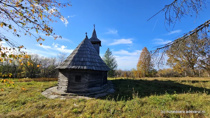
The church in Boia Bârzii. Photo by Daniel Guță
On the hills, other roads branch off from DJ 708 D, to reach the small villages of Merișoru de Munte, Muncelu Mare and Boia Bârzii, archaic villages inhabited by only a few families.
Transluncani, the way to Vârful Padeș
In Timiș County, the most spectacular road in the Poiana Ruscă Mountains was named Transluncani and is a 5-6 kilometer mountain road, inaugurated in 2019, which reaches near the highest peak of the massif, Vârful Padeș (1,382 meters) .
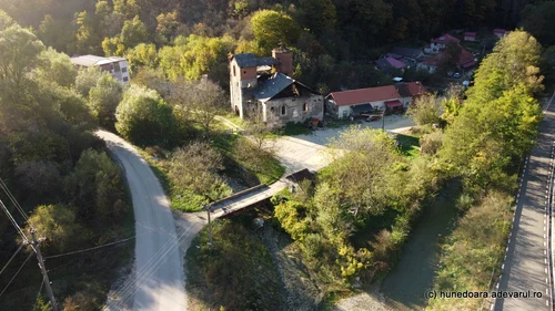
Image 1/20:
Valea Govajdiei Hunedoara Photo Daniel Guță (26) JPG
The mountain road from Tomești commune in Timiș – famous in the past for its glass factory – was built on the route of an old path that the locals from Luncanii de Jos used to climb with their animals on the meadows.
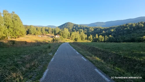
Image 1/10:
Transluncani Photo Daniel Guță THE TRUTH (80) JPG
“Approximately 60 percent of the road surface is in rock. It was not easy, we had many obstacles, but the builders managed to complete the project. But from the beginning I was sure that it would be a place of reference for Timiş county and the western area”, recounted Costel Medelean, the mayor of Tomești commune.
The Oboarele agricultural road, known to tourists as Transluncani, leads to a mountain plateau at about 800 meters above sea level, where travelers find a place of recreation and a few holiday homes. From here you can admire the ridges of the Poiana Ruscă Mountains, and in the distance you can see Vârful Padeș, the highest of the massif, located on the border of Hunedoara, Caraș-Severin and Timiș counties.

Image 1/20:
Mocănițel route Hunedoara Govajdia Photo Daniel Guță THE TRUTH (7) JPG
Then, the paved road descends steeply into Valea Lupului, where it intersects with a dirt and stone county road, the rehabilitation of which would open the way for tourists from Timiș County to Ruşchița, the village in Caraș-Severin County with the most famous marble quarry in Romania , located 12 kilometers from Transluncani (video).
From Tomești commune, another road goes up the Begăi Valley towards Bătrâna, the smallest commune in Romania, surrounded by centuries-old forests in the Poiana Ruscă Mountains. A little over 50 families live in the archaic villages of Batrâna, located at over 1,000 meters above sea level and over 50 kilometers from Deva and Hunedoara.
The Marble Road
In Caraș-Severin, the most attractive route in the Poiana Ruscă Mountains is called the Marble Road and starts from the village of Voislova, crossed by DN 68 Hațeg-Caransebeș.
From here, a county road of about 20 kilometers goes up the Ruşchiței Valley, crossing the towns of Rusca Montană and Ruşchița (video), before stopping at the foot of the great marble quarry in Ruşchița.
The Rușchița marble has been mined since the end of the 19th century, and the quarry that went deep into the mountain ended up occupying more than 40 hectares. Huge blocks of marble of various shades, from white to gray, pink, pinkish-yellow and reddish, are cut from here.
“Thanks to its fascinating beauty, the Ruschița marble has been integrated into famous projects from all over the world, thus gaining notoriety and appreciation worldwide. Kowloon Station (Hong Kong), Ardmore Park (Singapore), Marunouchi Center, Soka and Roppongi Asahi TV (Japan) are just a few projects made with marble from our country”informed the representatives of the marble quarry.
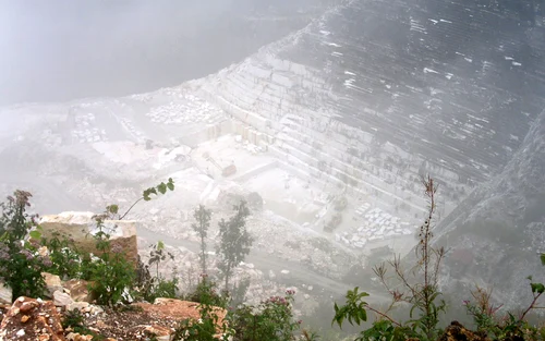
Image 1/5:
Marble quarry from Ruschița Photo Traian Manu (1) JPG
At the foot of the marble quarry, in the Ruschiței Valley, are the old mining villages of Ruschița and Rusca Montană, which have been in a prolonged economic decline since the 90s, when the iron, zinc, lead and uranium mines in the area were closed.
Towards old furnaces on the roads of the foresters
From the village of Lunca Cernii de Sus, located 50 kilometers from Hunedoara, a modern road descends to Valea Cernei (video) crossing several villages of foresters and then bypassing Lake Cinciș from Hunedoara.
Other branches of the road go up towards Vadu Dobrii, a picturesque village at 1,300 meters above sea level, inhabited by a few families, or towards Ghelari, an old mining center of Hunedoara.
From Ghelari, routes accessible by car lead to the village of Alun, famous for its marble road built in the 60s. Another road descends towards Govâjdia, the village known for its over two centuries old furnace, which is a historical monument.
From Govâjdia, a recently modernized road follows the Runcului valley, towards the village of Runcu Mare, 15 kilometers away, where travelers find dozens of archaic wooden houses, built in the early years of the 20th century.
From the furnace in Govâjdia (video), hiking enthusiasts can follow the route of the former railway from the Pădurenilor Land, which crosses the valleys of Govâjdia and Zlaștiului, and reaches Corvinilor Castle, located about ten kilometers away.
This railway was built in 1900 and was used until the 2000s when it was decommissioned. Now, its spectacular route, with numerous bridges and an 800-meter tunnel, is used by nature walkers, and some locals hope that in the future the mocanic railway can be restored and used for tourists.
Road posts
The highways that bring tourists closer to the Poiana Ruscă Mountains are the A1 Deva-Lugoj Highway that crosses the Mureș Valley and the European roads DN 68 A Deva-Lugoj, DN 6 Lugoj-Caransebeș, DN 68 Caransebeș-Hațeg and DN 66 Hațeg-Simeria.
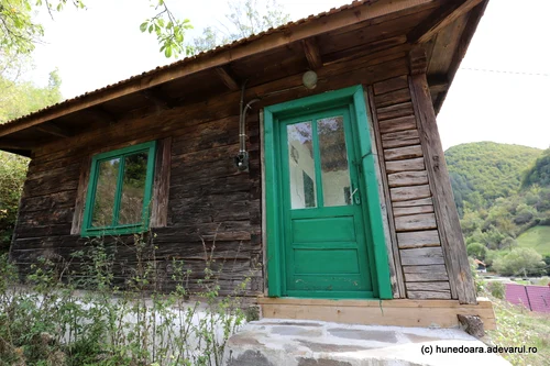
Image 1/25:
Runcu Mare Village, Hunedoara Photo Daniel Guță (23) JPG
Several county roads branch off from them that cross the cities of Deva, Hunedoara, Lugoj, Caransebeș or the communes close to them, then go up the valleys of some mountain rivers, through dozens of kilometers of forest, and then steeply towards the peaks of the Poiana Ruscă Mountains.
Most mountain trails start from the Old Center of Hunedoara, right at the foot of Corvinilor Castle.
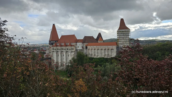
Corvinor Castle from Hunedoara. Photo: Daniel Guță THE TRUTH
In the past, this is where the mountain paths used by the inhabitants of the villages of the Pădurenilor Land came down to the market in Hunedoara, to sell their animals, food or the tools they made in the blacksmith workshops in the vicinity of the mines in the mountains.