
In anticipation of spring, many Romanians and foreigners are making travel plans for Via Transilvanica, the hiking route that crosses the Carpathians. Some have already traveled parts of the route of more than 1,400 kilometers and were amazed by the places they discovered.
Launched in 2018 and completed in 2022, with the inauguration of the last sections in Alba and Hunedoara, Via Transilvanica has become one of the most popular hiking routes in Romania.
Its route of more than 1,400 kilometers crosses the Carpathian Mountains, from the Putna Monastery in Bucovina to Drobeta-Turnu Severin, the place where the ruins of the bridge over the Danube are located, one of the “miracles” of Antiquity.
With spring approaching, more and more hiking enthusiasts are announcing their travel plans on this nature trail. Among them are also many foreigners, some already familiar with segments of the route, eager to return to the Via Transilvanica to explore other places, others seeking adventure for the first time.
Bucovina, the most popular segment on Via Transilvanica
When asked by the official Via Transilvanica group about the segment of the route they appreciated the most, most hikers pointed to the Bucovina region. The “start” terminal of the tourist route was placed at the Putna Monastery, and the Bucovina route, with a length of 136 kilometers, takes tourists to the hills that connect the regions of Moldova and Transylvania.
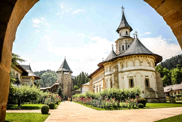
“From in front of the Putna Monastery, our road takes us towards the Sucevița depression, then passing through Vatra Moldoviței, through Obcinele Bucovina to Pasul Mestecăniș in Pojorâta commune, continuing slowly towards Țara Dornelor, embraced by the Giumalău, Suhard and Călimani Mountains. From there, the road winds through the hills and meadows to Poiana Negri, with its wonderful springs, stopping at Poiana Stampei, a locality that ends the route in the historical region of Bucovina”, show the initiators of Via Transilvanica.
At junction 100 of Via Transilvanica is Vatra Dornei, another landmark of the tourist route, appreciated by travelers. From the old balneo-climatic resort, surrounded by the Bistriței, Călimani and Giumalău Mountains, travelers make the gradual transition to Transylvania, leaving Bucovina once they exit Poiana Stampei.
“I traveled 362 kilometers on the Via Transilvanica, and Bucovina, especially Obcinele Bucovina, was the most beautiful. They are rare landscapes, especially from the top of the ski slope in Vatra Dornei”, states one of the hikers.
For another traveler, along with Bucovina, the hiking trail in the “Secuiesc Land”, the segment called Terra Siculorum, which crosses places in Harghita and Covasna counties, was almost as spectacular.
“Bucovina remains categorically the coolest, toughest and most challenging part of Via Transilvanica”, someone else adds.
Banatul Montan, preferred by many travelers
Someone else believes that all regions have their own attractive features, and those who believe that only Bucovina is worth visiting are wrong.
“I traveled 900 kilometers, I reached Hobita, but I liked Bucovina the most. Dream landscapes, five-star people”, says another Romanian.
Banatul Montan, located at the other end of the route, in the southwest of Romania, is also among the preferences of many hikers.
“The Banatul Montan was and will remain in my heart. I would always love to return to Terra Banatica, Romanian and Dacian“, says a tourist.
The initiators of the route called this segment Terra Banatica and set it up in Caraș-Severin, between the segments full of historical vestiges “Terra Dacica”, from Alba and Hunedoara, and “Terra Romana”, the last one on Via Transilvanica, from Mehedinți.
“Bucovina is beautiful, but Terra Romana is also fantastic! And in Terra Dacica you have some dream landscapes in the area of Fundătura Ponorului, at least. You don’t come out badly with Terra Banatica either, although there is a lot of forest there. Terra Saxonum is special, especially by combining the villages with nature… Honestly, of all, Tinutul de Sus is a little poorer, but not significantly”. another tourist thinks.
Via Transilvanica, journey in the heart of Romania
Via Transilvanica crosses the counties of Suceava, Bistriţa-Năsăud, Mureş, Harghita, Braşov, Sibiu, Alba, Hunedoara, Caraş-Severin and Mehedinţi, on paths and less traveled roads, which take travelers through places appreciated for their picturesqueness.
“Via Transilvanica unites not only the ten counties through which it passes, but also the entire ethnic, cultural, historical and geographical diversity of Transylvania and the entire country and, last but not least, all those who travel this route”, says Tășuleasa Social, the non-governmental organization that carried out the project.
The andesite bollards, individually carved and harmonized with the history and symbols of the places, adorn Via Transilvanica, forming an unusual art gallery, with pieces strung under the open sky every kilometer. The route of more than 1,400 kilometers was symbolically divided into several segments.
Located in the north of Romania, the first of these is Bucovina, with the emblematic places Mănăstirea Putna and Vatra Dornei. The second sector, with a length of over 250 kilometers, was called Șinutul de Sus and mostly crosses the Lunca Ilvei area, in Bistrița-Năsăud county, at the foot of the Rodnei Mountains. The city of Bistrita is a landmark of this route.
From the Bistrița valley, the hiking trail descends into Terra Siculorum (“Land of the Secuians”), crossing the Sovata–Praid depression and the hills of Transylvania. Travelers arrive in Szekler villages and pass through the resort of Sovata, located on the border of Mureș and Harghita counties, famous for its salt lakes.
Next is Terra Saxonum, the segment that crosses the center of Transylvania through the most picturesque settlements founded by the Saxons. A landmark of the region is the city of Sighisoara, famous for its documented medieval fortress from the 13th century, but also for its symbol, the Clock Tower, 64 meters high.
Terra Dacia crosses the counties of Alba and Hunedoara, through the Dacian fortresses and the first Roman cities on the current territory of Romania. Its landmarks are Cetatea Alba Carolina, Sarmizegetusa Regia and Ulpia Traiana Sarmizegetusa.
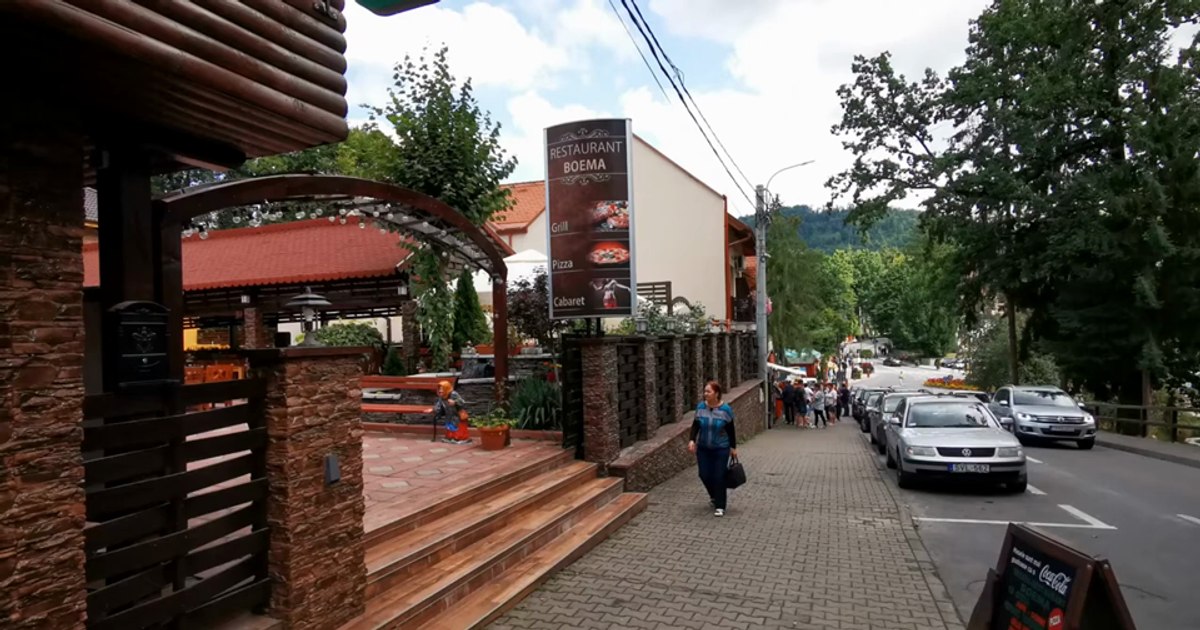
From the former capital of the Roman province of Dacia, travelers pass through the Iron Gates of Transylvania, a historical place that connects the counties of Hunedoara and Caraș-Severin, to enter the lands of the Banatul Montan, crossed by the Terra Banatica segment. The towns of Caransebeș and Reșita (video), as well as the mountain villages established in the Semenic Mountains by the Bohemian settlers, are landmarks of this land on Via Transilvanica.
Terra Romana, the last part of the Via Transilvanica route before reaching the Danube, crosses the wild plains of the Cernei Mountains, taking travelers through places rarely touched by humans. The route passes through several hard-to-reach and almost deserted villages – Ineleț, Scarișoara and Cracu Mare – among the few human settlements in the Domogled–Cernei Valley National Park, in southwest Romania.
A small deviation from the route that ends at Drobeta-Turnu Severin takes travelers to Băile Herculane, the oldest thermal water resort in Romania.