
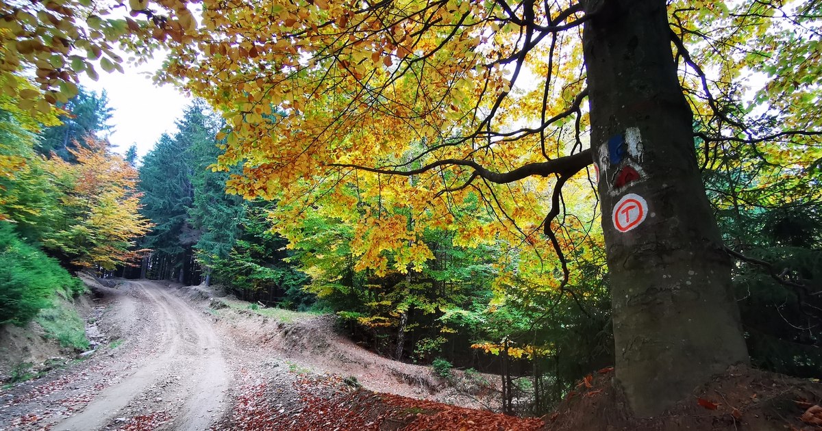
In autumn, the land of the Dacian fortresses, contained in the Grădiştea Muncelului Cioclovina Natural Park in western Romania, takes on a spectacular appearance. The beauties of the reserve are revealed at the end of five spectacular roads.
Road from Grădiștea Muncelului Cioclovina Natural Park. Photo: Daniel Guță. TRUTH
The reserve in the Șureanu Mountains (video – Luncani Cioclovina area) it stretches over more than 38,000 hectares, and forests dominate most of its views, occupying more than two-thirds of the park’s area.
With the cooling of the weather, until the leaves fall, the beech and birch groves are decorated in yellow-purple colors, mixed with the green shades of the coniferous forests.
On this vast mountain territory, less than 2,000 people live in the villages and hamlets of the communes of Pui, Orăștioara de Sus and Boșorod in Hunedoara.
Tourist attractions in Grădiștea Muncelului Cioclovina Natural Park
Most settlements seem forgotten by time. Small towns established centuries ago by foresters and animal breeders, such as Urșici, Cioclovina or Târsa, have preserved their patriarchal appearance.
Archaic villages occupy the peaks of the Șureanu Mountains, from the height of which the panorama of the entire massif is revealed, encompassed on the horizon by the ridges of Retezat and Parângului.
In places less visited in the past, sought after by more and more hikers in recent years, the picturesque hamlets and villages like Ponorici, Chicera Izvorului or Fundătura Ponorului are animated by the few animal breeders left here.
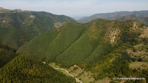
Image 1/10:
Valea Luncani Cioclovina Photo Daniel Guță THE TRUTH (22) JPG
Unlike other mountain areas in Romania, the hiking trails in Grădiștea Muncelului Cioclovina Natural Park remain accessible to travelers regardless of the season.
On the territory of the national park are the Dacian fortresses of Sarmizegetusa Regia, Costești, Blidaru and Piatra Roșie, UNESCO sites, but also other less known Dacian settlements. Also here are the great marching camps established by the Romans on the hills surrounding Sarmizegetusa Regia.
Dozens of caves can be explored within the park. The Cioclovina cave, the most famous of them, is located in a rock wall on the edge of the Cioclovina hamlet, near the Dacian fortress Piatra Roșie (video).
Equally spectacular, but less accessible, is the Şura Mare Cave (Pui commune), with a “gate” over 30 meters high, and the most accessible of the caves, which can be visited, is the Bolii Cave, in the vicinity of the towns of Petrila and Petroșani .
The five main access roads into the reserve
Five main routes can be used by tourists to reach by car Grădiștea Muncelului Cioclovina Natural Park and the territory of the reserve. The towns of Boșorod, Costești, Pui, Baru and Bănita are access points to the reserve.
“The main access points are: from DN 7, from Orăştie towards Costeşti (the main access point to most of the Dacian fortresses in the Orăştiei Mountains); from DN 66 / E79 from Călan towards Boşorod commune (access point especially for the Ponorici-Cioclovina karst complex and the Dacian fortress Piatra Roșie via Luncani – video The Truth) or towards Costeşti via Okolişu Mic; from Pui (towards the Șura Mare canyon, the Ohaba Ponor fossiliferous site and the Funătura via Ponor); from Baru towards Streiului Valley; from Banita (especially for the Cave of Disease)”inform the representatives of the national park.
Other secondary roads, some forest ones, go up the Luncanilor Plateau (via Târsa and Urșici) or towards the hamlets in the land of the Momârlans (Băniței area).
The condition of the roads to the monuments of the reserve
The most popular road to Grădiștea Muncelului Cioclovina Natural Park is the Orăștie – Costești – Sarmizegetusa Regia road (County Road 705 A), with a length of about 40 kilometers.
The road connects the Mureș Valley with the land of the Dacian fortresses in the Șureanu Mountains, being preferred by tourists due to its proximity to the A1 Motorway, with the Orăștie and Simeria Veche road junctions.
The route starts from Orăștie and goes up the Grădisti valley to the edge of Costești village, the place from where tourists can continue their journey on foot to the Dacian fortresses of Costești and Blidaru.
From Costești, the road sinks into the deep valley of Grădiști on the Costești – Sarmizegetusa Regia sector, 18 kilometers long, modernized in the period 2014 – 2015, also with European funds.
Currently, the sector of about 20 kilometers between Orăștie and Costești is in the construction site, to be modernized. Apart from the Dacian fortresses, branches of the county road lead to other attractions of the Șureanu Mountains: Vârtoapelor Plateau, Luncanilor Plateau, Godeanu peak.
The road to Cioclovina Cave
County Road 668 is the second popular access route for tourists entering the park. The road starts from the town of Călan, located on the Streiului valley, 10 kilometers from Hunedoara and crosses the valley of the Luncani stream, through the villages of Boșorod commune, for a distance of about 25 kilometers until near the Cioclovina Cave (video).
Currently, the road is asphalted up to the exit from Boșorod village and is in the construction site to be modernized on the Boșorod – Luncani sector. The last five kilometers of the road are dirt and stone, but accessible by car.
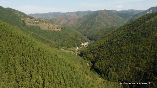
Image 1/14:
Valea Luncani Cioclovina Photo Daniel Guță THE TRUTH (12) JPG
On this route, tourists can reach the Cioclovina Cave, the Dacian fortress Piatra Roșie, the archaic villages of Urșici and Cioclovina, at the foot of the Țafla Peak. From Cioclovina, hiking enthusiasts can climb the Ponorici meadow, one of the natural park’s attractions.
The road to Ponorului End
From Șara Hațegului, crossed by National Road 66, three roads go up from the Streiului valley to the spectacular places in the Șureanu Mountains.
One of them starts from the edge of Pui commune, towards Fundătura Ponorului, located about 15 kilometers from the center of the town (video).
“The road to Fundătura Ponorului is quite difficult for the last kilometers starting from the village of Pui, being a mountain road, mostly practicable only with off-road vehicles”, says Lucian Ignat, a photographer from Hunedoara, who recently visited Fundătura Ponorului (video).
This road passes near the Șura Mare Cave (video), one of the natural monuments on the territory of the reserve.
The road to the springs of Streiului
A forest railway operated until the beginning of the 1970s in the Streiului valley (video), starting from the village of Baru towards the sources of the legendary river, located in the land of Dacian fortresses in the Șureanu mountains, at the end of a route of over 20 kilometers.
In place of the railway on the lower course of the Streiului, a forest road has remained that crosses the forest at the foot of several peaks over 1,000 meters above sea level. Several caves and the famous waterfalls of Šipot can be visited on this route, where the waters have shaped the calcareous relief, creating amazing formations.
Travelers who continue their way to the springs of Streiului cross several small meadows, used by the locals as hayfields, from which paths lead to the villages and stables in the Paltinu, Bulzu, Teiu Lung, Porumbeii mountains.
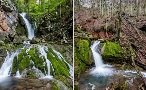
Image 1/12:
Sipot Waterfalls Photo Lucian Ignat (1) jpg
Other forest roads that intersect with the road from the Streiului valley go up to the plateaus at over 1,000 meters of the Șureanu mountains, from where the tourist routes continue to Poiana Omului, Sarmizegetusa Regia, Fundătura Ponorului or Cioclovina Cave.
From Cheile Bănîței in the Șureanu Mountains
The southernmost entrance gate to the Grădiștea Muncelului Cioclovina Natural Park is located in the Băniței area (video), where the Dacian fortress Bănita and the Cave of Diseases are the main tourist attractions. The Bănita and Merișor passes connect Șara Hațegului with the cities of the Jiului Valley, located at the foot of the Parâng, Retezat and Vulcan Mountains.
The road to Peștera Bolii starts from DN 66 Hațeg Petroșani, and the entrance is about one kilometer from the national road. Cheile Băniței Reserve is also located in Grădiștea Muncelui Cioclovina Natural Park, near the Bolii Cave.
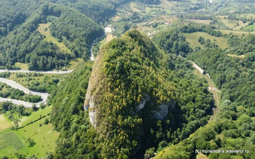
Image 1/12:
Dacian citadel Bănita Photo Daniel Guță THE TRUTH (80) JPG
Near the Cheile Băniței, tourists can also visit the medieval Tower of Crivadia and the Cheile Crivadei. They can also climb the paths and forest roads in the Șureanu Mountains, towards the springs of Streiului, or towards the Retezat Mountains on the trails that start from the area of Pui. Nearby, there are the cities of Valea Jiului and the villages of Baru, Pui and Bănita communes.