
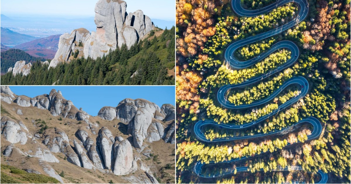
The most spectacular section of the National Road 1A Bucharest – Brașov, 184 kilometers long, is located in the vicinity of Cheia din Prahova, the place where several trails in the Ciucaș Mountains start.
The road from the Ciucaș Mountains. Photo: Lucian Ignat.
On the DN1A, travelers cross a sector of about four kilometers of serpentines, strung in the forests of the massif.
Photographer Lucian Ignat captured in aerial images the road section that made the Cheia area one of the attractions for hiking enthusiasts.
“Although it is less known than other mountain roads in Romania, the road from Cheia covers an extremely picturesque route, and in autumn, the colors in which the forest is decorated make it an ideal place for lovers of nature trips”says Lucian Ignat.
National Road 1A (video Lucian Ignat) represents an alternative for National Road 1 Bucharest – Brașov, much more congested on the section on Valea Prahova.
From Ploiești, drivers traveling on DN 1A enter the Teleajen valley, going up to Vălenii de Munte and Cheia, and from here cross the Oriental Carpathians through the Bratocea Pass (1,263 meters), then go down to Săcele, near Brașov.
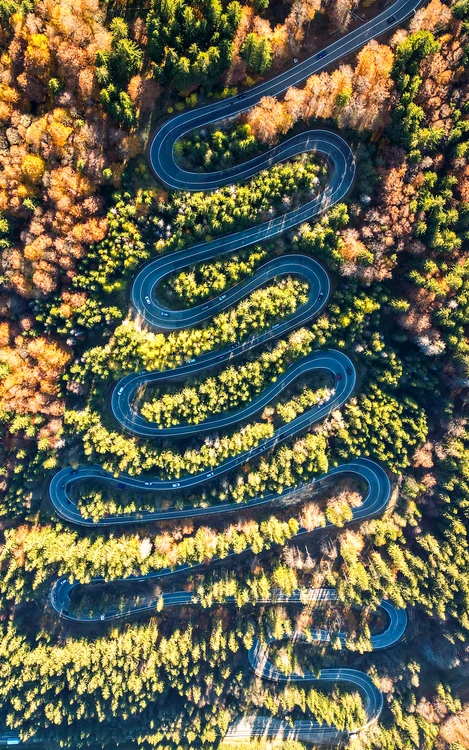
DN1 A. Photo: Lucian Ignat
The town of Cheia belongs to the commune of Mâneciu and was established at the end of the 19th century, in the vicinity of the Cheia Monastery. Originally, the village of Cheia was called Teleajen and included households established by shepherds who came over the mountains from Transylvania.
In 2000, Cheia was declared a tourist resort, due to the numerous natural monuments around it.
Ciucaș Reserve
The most popular are in the Ciucaș Mountains (video Lucian Ignat), included in the Curbura Carpathians, whose main peaks are Ciucaș (1,954 meters), Gropșoare (1,883 meters), Tigaile Mari (1,844 meters) and Zăganu (1,817 meters). DN 1A crosses the Ciucaș site, of community importance, included in the Natura 2000 ecological network.
The protected area located on the territories of Brașov and Prahova counties has an area of approximately 22,000 hectares.
“Access to the site is provided only by road means. The main access road is on the national road Ploieşti-Braşov (DN 1A), which crosses the park in its South-West part, through the most picturesque road sector of this road between km 132 and 167. In the North, the access it is possible on the modernized communal road Brădet-Vama Buzăului separated from the national road Braşov-Buzău (DN 10). A secondary access road to the park, but not recommended for vehicles, is on Valea Zizinului, on the degraded communal road Braşov – Târlungeni – Zizin – Vama Buzăului”it is shown in the management plan of the Ciucaș site.
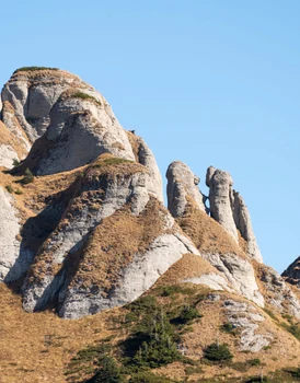
Image 1/12:
Ciucaș Mountains Photo Lucian Ignat (1) jpg
The Ciucaș massif looks like a stone citadel, adorned with rocks shaped by the climate and the passage of time. It did not preserve traces of the glaciations, instead the erosion outlined rocks with spectacular shapes.
“Characteristic for the geographical landscape of Ciucaş is the extensive development of the ruin-shaped relief in the high region. This, as in Ceahlău and Bucegi, is the result of the natural processes of cryonival modeling of the thick layers of conglomerates resulting in the formation of the residual relief. Colții Bratocei, Tăgăile, Colții Zăganului, Colții Nitrii, Stânca Vulturilor, Mana Dracului, Babele la sfat, Ciuperca, Bratocea Sphinx, Goliath Tower, etc., are a special attraction. These elements, which increase the value of the landscape, have not only different shapes but also different heights, from barely 4-5 meters, such as the mushroom-shaped rocks between Tîgăile Mari and Babele at the tip, to 40-50 meters such as Mâna Dracului up to 80-90 meters, in the case of Colţia Bratocea (Gh. Niculescu, 1982)”, it is shown in the management plan of the Natura 2000 site.