
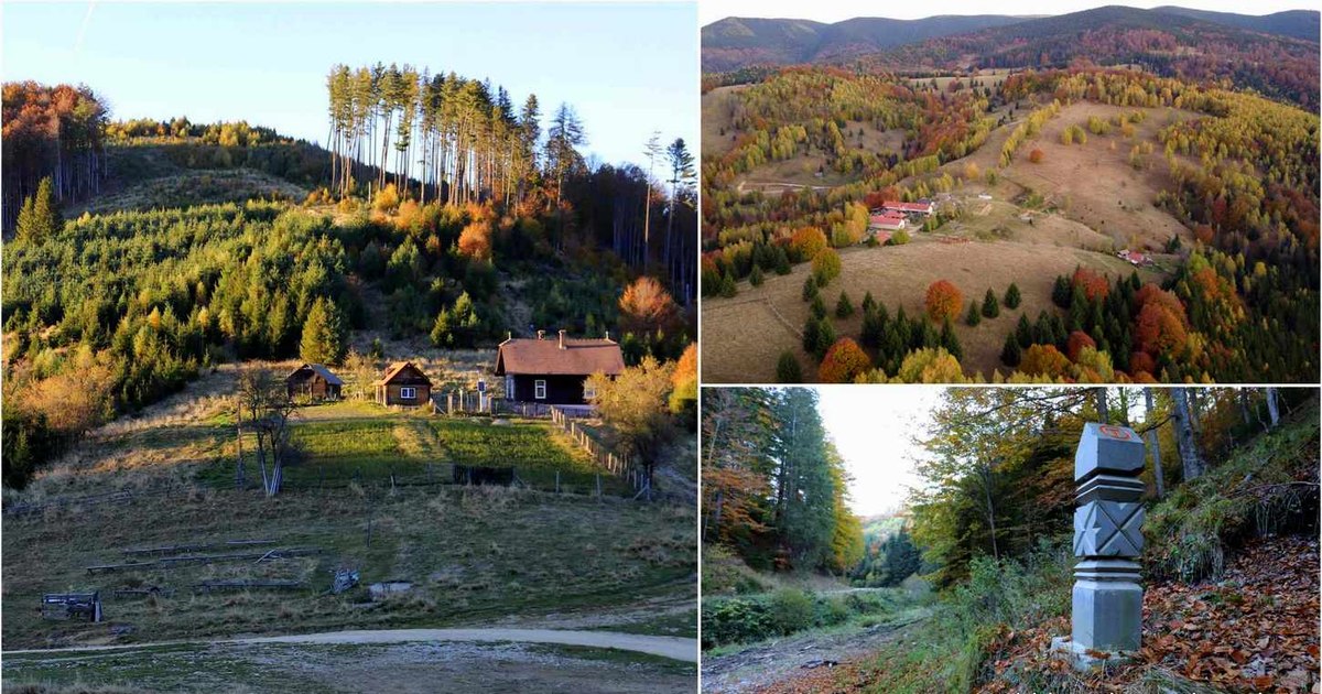
The village of Măgureni in the Șureanu Mountains had remained deserted in the 2000s, before a hermitage was built here, near Godeanu Peak – also called the holy mountain of the Dacians. However, the settlement is sought after by more and more tourists, being crossed by the Via Transilvanica.
Magureni village. Photo: Daniel Guță THE TRUTH
In Hunedoara, most of the Via Transilvanica hiking trail crosses the Șureanu Mountains, the land of Dacian fortresses and shepherd villages, scattered in the mountains.
Before descending from Vârful Godeanu (1,659 meters) – also called the holy mountain of the Dacians – to Sarmizegetusa Regia, travelers on the Via Transilvanica pass through the former village of Măgureni – now a hamlet enlivened by a small nunnery built here in the late 2000s .
The Măgureni hamlet, sought after by tourists on Via Transilvanica
Around it, on the hills, you can see the old households from Măgureni (video – The truth), a settlement located at about 1,300 meters above sea level, founded in the 19th century by the families of shepherds and woodcutters from the Șureanu Mountains.
Outside the hermitage, no house has been permanently inhabited for many years, instead some locals have turned their houses into cabins for tourists who cross Via Transilvanica.
“So far we have hosted Romanian tourists, as well as Australian, American, German, Argentinian tourists and we are waiting for an Argentinian to come these days, traveling the Via Transilvanica. Most came by September. All foreigners were extremely delighted by the beauty of these places and we are happy that for several years, the Măgureni hamlet has been reborn“, says Aurelian Țamba, a local from Măgureni, who made the house he lived in available to tourists, through the Via Transilvanica guide.
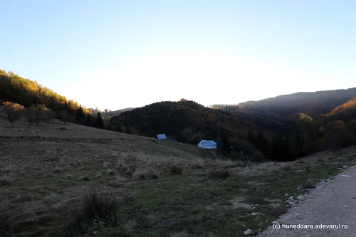
Image 1/10:
Măgureni village Photo Daniel Guță THE TRUTH (111) JPG
Aurelian says that he was part of the last generation of students of the school in Măgureni, abolished in the early 70s. At that time, five students were still studying in the school in the mountains, from grades I to IV. The village, which at the beginning of the 20th century had about 20 families, was almost completely depopulated by the end of the 90s, when two or three elderly people remained here.
People died out or left, instead, a hermitage of nuns was founded here, and some of the old houses have been renovated and are used as vacation spots or for the increasing number of tourists in recent years.
“It is probably the most isolated place where I have had the opportunity to sleep overnight, and it seems to me a unique experience. I sincerely hope that once Via Transilvanica passes through this place, the village of Măgureni will be reborn. I wish this for all the abandoned villages encountered along this route.” reports a tourist, who stayed overnight in Măgureni, on Via Transilvanica.
The village of Măgureni, also sought after by tourists in the past
The village of Măgureni was founded in the 19th century by families of cattle and sheep breeders and workers in the vast forests of the Șureanu Mountains. Back then, it was surrounded by centuries-old fir forests, but it had no roads.
“Everything was transported on horses and in wagons, traveling on foot paths and paths that were almost impassable in winter. People would go to the fair in the city on Friday, have a host in Sibişel and on Saturday morning they would go to the market in Orăştie, buy food, take them to the mill and go again to the host in Sibişel, where they would sleep at night and only arrive home on Sunday at noon . In the period without a forest road, the inhabitants of the hamlet traveled on poorly maintained paths, around Puntea Fetii Mari, Piatra Puşcata, Izvorul Dulce, Curmătura Delutului, Poiana Gardului, Delută and Tarniţa, exiting the Mare River near Piatra Neamţului“, says the Town Hall of Beriu commune, to which the hamlet belongs.
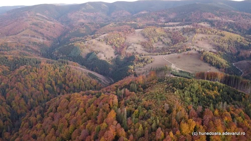
Image 1/15:
Măgureni village Photo Daniel Guță THE TRUTH (96) JPG
The trunks of the trees cut in the mountains were lowered into the rapid mountain waters that descended into the Sibišel valley.
“The wood from here was transported on foot by wild floating to Greblă-Orăştie, where it was removed from the water. There followed the period when wood was transported on a jilip, a wooden construction, 1-2 km long, on which water was introduced. Here there were such jilips on the Gliva River, the Măgureni Valley and the Alunului River”show the monographic documents presented by Beriu City Hall.
The road to Măgureni, built in the 1930s
In the 1930s, when the forest road of about 20 kilometers was built that went up from Sibišel to Măgureni, in the valley of Sibišel, the mountain village became more and more attractive for hiking enthusiasts.
“A new communication artery was opened in the mountains of Orăştia, covered with centuries-old forests of fir, pine, gorun, etc., on a 16-kilometer stretch from Sibişel to Măgureni, a hamlet located at 1,300 meters above sea level. This made it easier to transport the fir tree, giving a useful impetus to the construction works and a new source of income for the population of this land. And from a strategic point of view, this road is of great importance, which must be extended and extended, unconditionally, up to the Godeanu peak, opening through this road direct and faster communication, although over the mountains, with the old kingdom, across the old border, in connection with the new road opened over the mountains of Sebeş”informed the newspaper Universul, in 1936.
Since then, the road was proposed as a route both for travelers interested in the beauty of the alpine area of the Șureanu Mountains, but also for scientists, interested in getting to know the ancient settlements (Dacian fortresses and Roman forts) that dot the mountains.
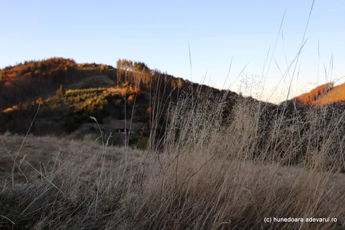
Image 1/23:
Măgureni village Photo Daniel Guță THE TRUTH (58) JPG
“If Sibişelul, for those from Orăştie, is a suitable place for easy excursions, for tourists it is a place of departure in the beautiful mountains of Sebeşul. Starting on the mountain roads, which lead along the Rîuşor, on the path that goes up to the ridge of the Delut (1,119 meters), we reach Măgureni, a small specific mountain settlement, composed mainly of sheep. Located near Orăştie (no. 30 kilometers), in the middle of mountains over 1,000 meters high, it is often explored for recreation. From Măgureni to the south we can take the road to Vârful Godeanu, but not the easiest. We recommend guides among the peasants from Sibişel or Măgureni, from whom we can also rent horses”the historian Octavian Floca pointed out, in the Hunedoara County Guide (Deva, 1969).
Via Transilvanica in Hunedoara
Via Transilvanica is a 1,400-kilometer long hiking trail that starts from Putna, crosses Transylvania and ends at Drobeta – Turnu Severin.
The cultural route, which can be completed on foot or by bicycle, crosses the counties of Suceava, Mureş, Harghita, Braşov, Sibiu, Alba, Hunedoara, Caraş Severin and Mehedinţi.
In Hunedoara, Via Transilvanica (video – The Truth) it runs 150 kilometers passing through the Natural Park Grădiștea Muncelului – Cioclovina and at the foot of the Retezat. It starts from the area of Cugir (Alba) – Romoșel, goes up to the village of Ciungu Mare, continues on forest roads to the hamlet of Măgureni, descends to the foot of Vârfului Godeanu, to Sarmizegetusa Regia, then to the valley of Grădisti, in the village of Grădiștea de Munte.
From here it climbs again to the Luncanilor Plateau, to Târsa and Poiana Omului, and continues through the Ponorului Fund in the Șureanu Mountains.
After passing through the communes of Romos, Beriu, Orăștioara de Sus, Boșorod, Pui, the route continues through Retezat, crossing the tourist areas of the communes of Sălașu de Sus and Râu de Mori, then descends to Șara Hațegului, to Sarmizegetusa (Romanian), leaving the county through Portile of Iron of Transylvania, towards Bucova (Caraș-Severin).
Romanian and international artists have transformed the kilometer markers into works of art, sculpted in andesite.