
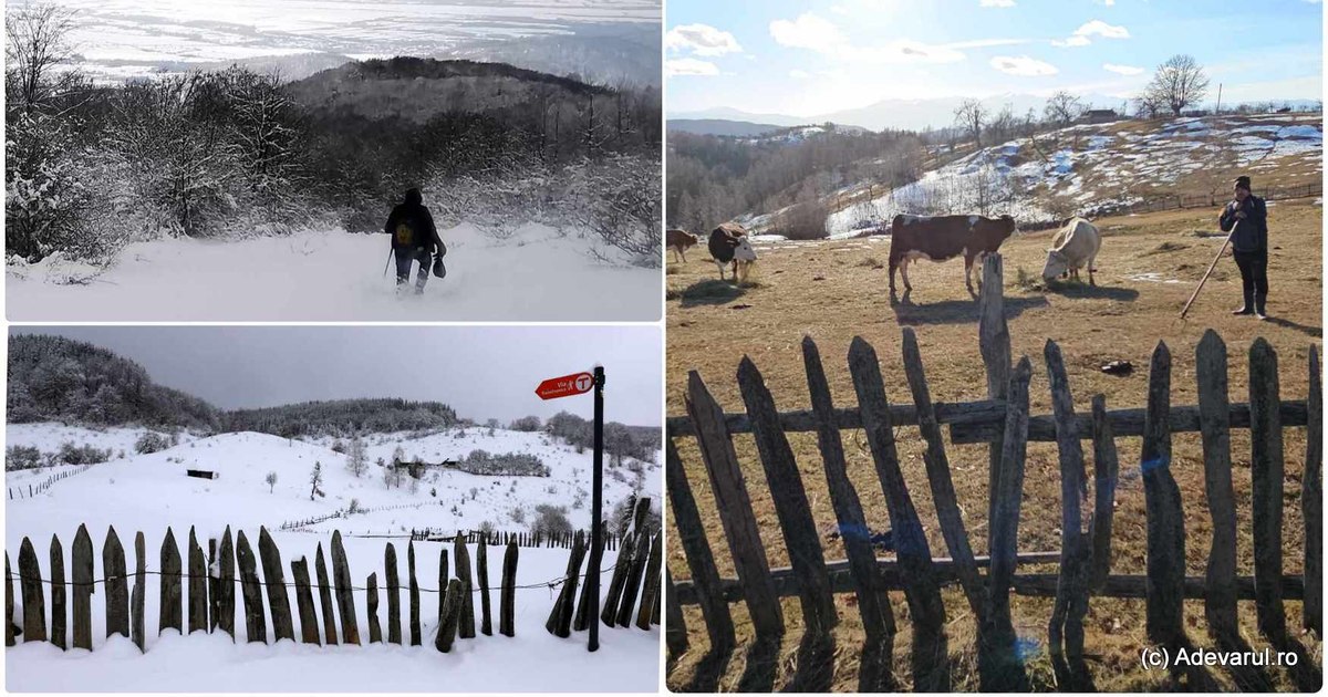
In winter, most of the wilder lands on Via Transilvanica are rarely frequented by tourists, but those who dare to start on the road through the regions crossed by the route of over 1,400 kilometers from the Carpathians of Romania have numerous reasons.
Views on Via Transilvanica. Photo: Daniel Guță. TRUTH
Via Transilvanica, the long hiking route of over 1,400 kilometers that cross the Carpathian Mountains, linking two emblematic places for the history As a tourist route in 2022, when its last sectors were arranged, in Hunedoara and Alba counties.
Since then, countless Romanian and foreign travelers have taken the country on foot, on foot or by bicycle, the most daring being ambitious to travel the complete route, through the ten counties they cross: Suceava, Bistriţa-Năsăud, Mureş, Harghita, Braşov, Sibiu, Alba, Hunedoara, Caraş-Severin and Mehedinti.
“Via Transilvanica unites not only ten counties that go through, but also the whole ethnic, cultural, historical or geographical diversity of Transylvania and the whole country and, last but not least, all who go through this route”showed Tășuleasa Social, the non -governmental organization that carried out the project.
Ponor’s foundation, deserted in the quiet of winter. Photo: Daniel Guță
Crossing the entire Transylvanian via requires good physical training, ambition, nature’s knowledge and a few weeks of free time dedicated to the trip. Therefore, most tourists go only on certain segments of the route. Those who want to cross it from one end to the other begin their journey during the summer, when the weather is more favorable, and the days are longer. The locals who offer accommodation in the pensions and houses on the route have observed this.
“Most tourists come from May until September. We have hosted Romanian tourists, but also Australians, Americans, Germans, Argentinians so far. All the foreigners were extremely pleased with the beauty of these places and we are glad that for a few years, with the help of Via Transilvanica, and the Măgureni hamlet “, The relationship Aurelian Țambă, a local from the Măgureni hamlet in the Șureanu Mountains (Hunedoara, video) who made available to tourists the parental house, through the Via Transilvanic Guide.
In winter, the forest road to the Măgureni hamlet is, as well as other mountain areas of Via Transilvanica, extremely difficult to travel. The last ten kilometers of the road slip on the Sibișelului Valley in Hunedoara, a river that springs from the Șureanu Mountains and then climbs steeply to the Coams of the mountain on which the former shepherd village had been set up, now left by the locals and animated only by a nuns. It crosses a completely wild area where meetings with bears and wolves are not surprising for locals.
A requesting season
In winter, tranquility encompasses a large part of Via Transilvanica, and many of its fairy tale places are difficult to access to foot or bicycle enthusiasts. On the difficult roads that are sinking in mountains and forests, often covered with snow and ice or soaked with mud, the rhythm of hiking is lower in winter, either because of the land or the heavier luggage.
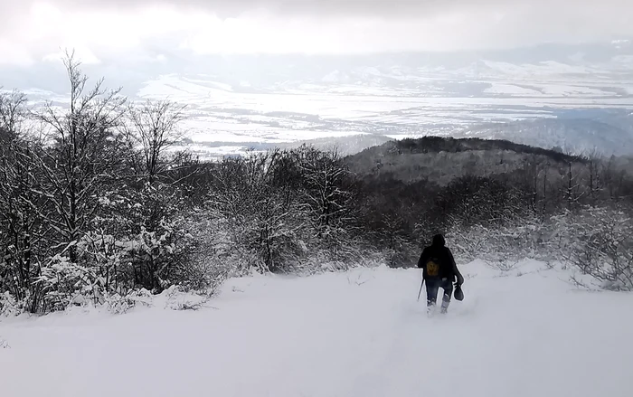
Winter landscape in the Șureanu Mountains. Photo: Daniel Guță
The mood can be more alert, because the risk of meeting wild animals, especially bears – frequently remembered in the mountains on the mountain – is higher. Even in the places where the presence of savages is rarely reported, the journey requires stronger nerves in winter. The light of day, smaller in the cold season, can be discouraging for long -hiking lovers in nature and for those who want to enjoy as much as possible from the iconic landscapes of some places on Via Transilvanica.
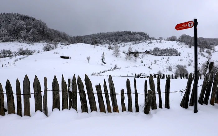
Snow -covered path, via Transilvanica. Photo: Daniel Guță
However, those determined to start on the road must prepare in advance. When it comes to such adventures, specialists say packing is the key to success. Before starting their adventure, tourists must investigate the climate of the area they will cross to know what kind of clothing to put in their luggage and keep in mind that in the mountains the weather is unpredictable.
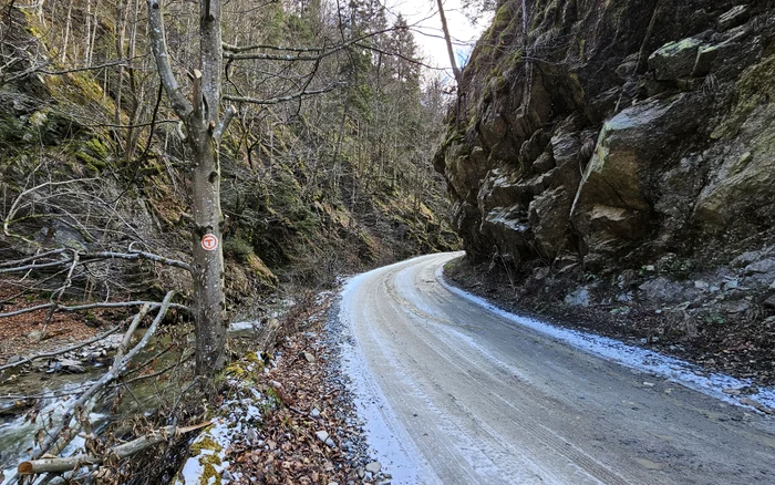
The road to the Poiana man. Via Transilvanica. Photo: Daniel Guță
Travelers do not have to forget about hats, gloves, waterproof and warm footwear, a blanket that can be used if necessary, but not lanterns or communication and navigation systems.
Much of Via Transilvanica reaches in mountain areas, where hiking are, in winter, much more demanding for the body, the consumption of calories typically being much higher.
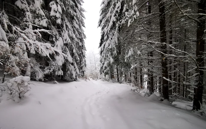
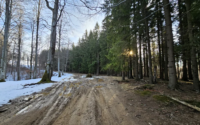
Forest road from Via Transilvanica. Photo: Daniel Guță. TRUTH
In such situations, people need adequate hydration, to adjust their body temperature, and more food, to keep their energy needed for long distances. Therefore, it is not the right time to keep the diet or leave the can with water at home.
“Consult the weather bulletins, announce the close ones on which route you will go. Follow the advice of an experienced person, a good connoisseur of the area you want to go through. Ask for information from professionals: mountain rescuers, mountain guides, cabins, ski monitors. Do you consider that there is no safe area ”informs Salvamont Romania those who want to travel mountain trails in winter conditions.
The quiet of the forest, disturbed by the drujbe
Some tourists have shared their experience of winter hiking on Via Transilvanica. The first impressions on the route are full of emotions, says Paul, a tourist who has crossed 65 kilometers in the first part of the route, which starts at the Putna Monastery and crosses the Land of Bukovina.
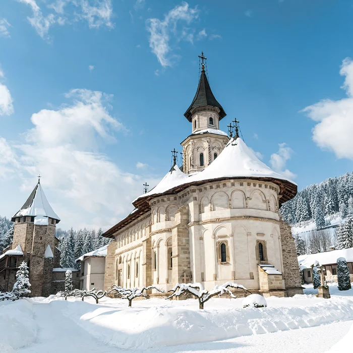
Putna Monastery. Source: Facebook. Putna Monastery
“For me it was the first longer hiking attempt. I carried only fears and uncertainties in my luggage. On the one hand because we left in winter, when we did not expect to be other travelers and we did not expect to find accommodation. On the other hand, I didn’t know much about the route. I only knew that the part of Bucovina is considered by many to be the most difficult. The portion by which you are traveling, say many who have already crossed it. And we chose to start it in winter. Is the short winter day enough for daily distances? Do bears really hibernate at this time? Can I get my feet so bitter on my way? Now I am proud that I have survived the three days in Bucovina and I can confess: Via Transilvanica is really crossing in winter. Moreover, it is wonderful ”says the tourist, in the official group via Transilvanica.
The traveler and his companions observed the wonder of some of the hosts and the people who were encountered, who asked them how they started on the road in the middle of winter.

Putna. Source: Putna Monastery. Facebook
He found the deserted sheep, so that the fear of reaching the path of protective shepherd dogs with their territory wasted leaving the place that they are “for a walk through Switzerland,” he said. The sheep and meadows filled with tranquility were charming in winter, but the contemplation state offered by the view of such places was often disturbed by the maid made by people.
“From a corner of the forest, a saw. From a hill edge, some enduro motorcycles. From above, from the sky, a plane. Although I kept singing and screamed after bears, I probably did it for nothing. It was already enough ambient joke anyway, and the hours when we only heard the sounds of our steps were short ”he reports.
Seven lands, a single road
Signed with tourist and orientation indicators on its entire distance of over 1,400 kilometers, via Transilvanica differs from other tourist routes in Romania and through its kilometric terminals, stone monuments carved by artists, reminiscent of the history of places and also shows them that I’m on the right track.
Some of these also announce the entry into the seven lands in which the longest hiking route in Romania was divided: Bucovina, Sus Land, Sicerum County, Terra Saxonum, Terra Dacica, Terra Banatica, Terra Romana.
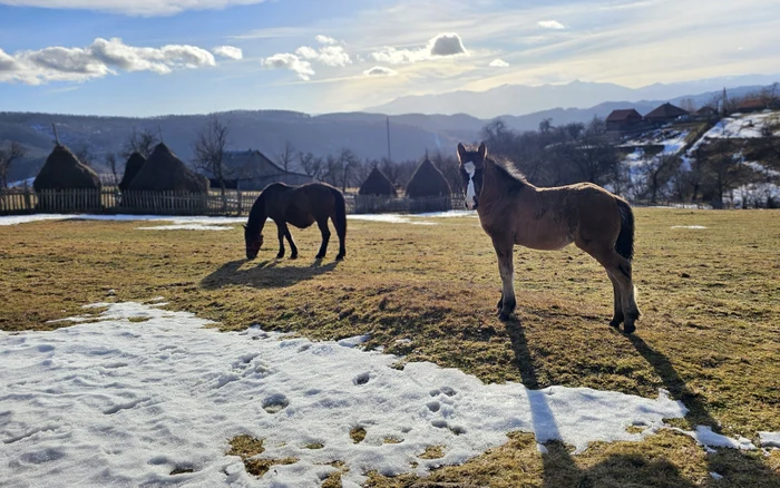
Rural landscape on Via Transilvanica. Photo: Daniel Guță. TRUTH
In Bucovina, the most visited place on Via Transilvanica is the Putna Monastery, the starting point of the hiking route. Tourists arrive here in large numbers in any season, the monastery being known as the place where Stefan cel Mare was buried. From here, the travelers start on a difficult route, to the Depression of Sucevița and the Country of Dornelor, which crosses the land of Bucovina over a distance of 136 kilometers to Poiana Stampei.
“Bucovina is a challenge. It is an attempt for hiking, but also a kind of blessing, that once they have crossed their obcils, they are ready to end a long distance route. inform the official page via Transilvanica.
The land of the Szeklers and the Saxons
From Bucovina, the travelers from Via Transilvanica continue their way on the 277 kilometer route of the top land, which crosses the counties of Bistrița-Năsăud and Mureș, with a diverse relief, passing from the mountains to Ses. The area is accessible in winter, and the tourists find here the picturesque village Piatra Fântânele, with the Campus Tășuleasca, the place where the story Via Transilvanica began and where the more than 1,400 terminals of the route were carved.
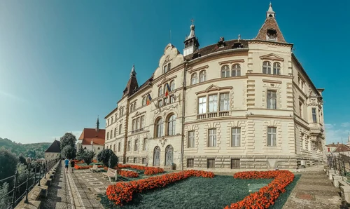
Image 1/5:
Sighisoara photo Lucian Ignat jpg
From the top land, the hikes descend through “Terra Siculorum”, the Latin name of the Szekler County, an ethnographic region where the Szekler communities have best kept their traditions and local specificity. The Sovata Balnear resort in Mureș is in the top of the attractions of this region, in winter, Lake Ursu being its landmark. Salina Praid and the city of Odorheiu Secuiesc are also among the attractions of this portion of the route.
From Archita, in Mureș county, the hiking route continues on about 200 kilometers in Earth Saxonum or Saxon County, in Brasov and Sibiu counties and the settlements in Transylvania Plateau. The city of Sighișoara is the most sought after place in this region of Via Transilvanica, but the travelers also reach Mediaș and smaller, picturesque localities, with the specific architecture of the Saxon communities.
“This region reminds us of the inheritance left by Saxons in Transylvania, with architecture specific to housing and households, with fortified churches, with the Tower of Slăninii”, informs representatives via Transilvanica.
On the footsteps of the Dacians and Romans
From the settlements that have retained the cultural identity of the old Saxons communities, via Transilvanica descends to Alba and Hunedoara, on the portion called “Terra Dacica”. Here, travelers find some of the wildest areas on the hiking route, but also the ruins of the most famous Dacian fortresses in Romania.
Located in Hunedoara, the two ancient capitals Sarmizegetusa Regia and Ulpia Traiana Samizegetusa (video), the landmarks of the region, are also accessible in winter.
From the Iron Gates of Transylvania, the legendary pass between the historical regions of Transylvania and Banat, the travelers enter the “Terra Banatica” on Via Transilvanica, following the former imperial route from Roman times, to Caransebeș, the city built on the ruins of the Roman settlement Tibiscum. Then he continues towards Reșița, the city of the ancient metallurgical factories of Banat and sinks into the lands of Banat Montan.
The last portion of Via Transilvanica, “Terra Romana”, carries tourists through the wild land from the Izvoarele Cerna, in Caraș-Severin, Gorj and Mehedinti, finally reaching the Danube, at the Iron Gates and in Drobeta-Turnu Severin. The trip of tourists on this long route ends on the ruins of Trajan’s bridge over the Danube.