
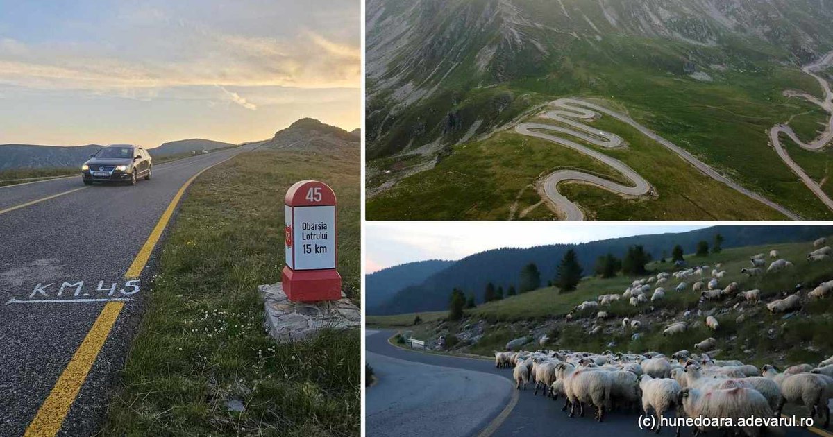
Accessible along the entire route only a few months a year, degraded on some ridges of the Parâng Mountains, Transalpina (National Road 67C) has become one of the most popular mountain roads in Romania.
Transalpina, the king’s road. Photo: Daniel Guță. TRUTH
The road from the Parâng Mountains crosses the Lotrului valley, in a wild land, located on the edge of five counties: Hunedoara, Sibiu, Alba, Vâlcea and Gorj. Transalpina is among the most famous mountain roads in Romania.
Restrictions on Transalpina
The most spectacular sector of DN 67C, about 30 kilometers long, between Rânca and Obârsia Lotrului (video), was reopened to road traffic from June 1, 2024, but for the safety of those who transit it, the road administrators imposed strict traffic measures.
“The mountain road sector between Rânca and Curpat of the DN67C (Transalpina) is reopened during the day, between 08:00 and 18:00. Outside of this time interval, access is prohibited for objective reasons related to the specifics of this mountainous area located at high altitude. Also, the speed limit on this road sector is a maximum of 30 km/h and the access of cars with a maximum authorized weight of more than 3.5 tons is prohibited. Compliance with these restrictions is mandatory to avoid dangerous events and to drive safely“, recently informed the National Road Infrastructure Administration Company SA (CNAIR).
One of the most spectacular mountain roads in Romania
Another thing that gives Transalpina the status of a unique road in Romania is the height it reaches.
The road from the Parâng Mountains (video) climbs up to over 2,000 meters above glacial caldera and alpine pastures, and the views offered to travelers are spectacular. During this period, not only tourists animate Transalpina.
From place to place, going up from the Lotru valley to the Urdele Pass (2,145 meters) – the highest point crossed by the Transalpina, travelers encounter a lot of flocks of sheep, accompanied by vigorous shepherd dogs, but also cattle and horses, animals allowed to roam the pastures.
A few picturesque barns, set back from the road, adorn the valleys, while on the heights patches of snow in the shady places still resist the summer. On the side of the road, other, more modern stables have become rest stops for hikers, and those who stop here are invited to portions of traditional pastoral food. Some travelers prefer to stay overnight, at stops or with a tent.
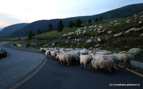
Image 1/14:
Transalpina Photo Daniel Guță THE TRUTH (210) JPG
Usually, the Transalpina remains accessible to tourists, only until October – November, when the frost and the first snows increase the risk of accidents.
How do you get to Transalpina?
The National Road 67C crosses the ridges of the Parâng Mountains, from Novaci (Gorj) to Sebeş (Alba), for a length of almost 148 kilometers. On the most spectacular sector, between Obârsia Lotrului and Pasul Urdele, the road was asphalted in the 2000s, but remained covered with yellow markings, specific to the roads in the construction site.
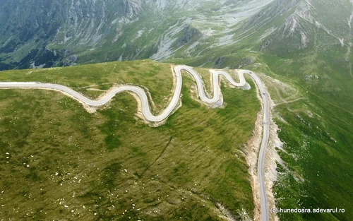
Image 1/17:
Transalpina Photo Daniel Guță THE TRUTH (105) JPG
Work is still needed to increase the degree of safety, as well as repairs, because in the ridge areas and on the serpentines, numerous bumps and cracks have appeared in the asphalt.
Those who choose to enter the Transalpina, from the Jiului Valley, cross the Jietului Gorge from Hunedoara (video), a spectacular area on National Road 7A, Petroșani – Obârsia Lotrului.
The Jietulu gorges in Hunedoara stretch over an area of about ten hectares, at the foot of the Parâng and Șureanu Mountains, near the towns of Petrila and Petroșani.
Image 1/15:
Cheile Jietului in Hunedoara Photo Daniel Guta THE TRUTH (27) JPG
“The Cheile Jietului nature reserve in Hunedoara, 11 kilometers long, with steep cliffs, waterfalls, mountain trails, a road that allows access to Transalpina, is little traveled and explored, and new caves can also be discovered in the area“, informs Petrila City Hall.
How the Transalpina was built – The King’s Road
The Transalpina, the road that crosses the Carpathians, through the Parâng mountains, has become a popular tourist attraction in recent years, and legends have multiplied on its account.
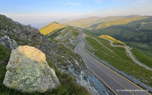
Image 1/16:
Transalpina Photo Daniel Guță THE TRUTH (37) jpg
Some authors found its ancient origins, showing that it would have been built by the Romans, during the wars of the beginning of the second century, something scientifically undocumented. Other authors called it the Devil’s Path, claiming that it was laid out more than two centuries ago, with the contributions of the locals from the surrounding villages. Until the beginning of the 20th century, the mountain road through the Urdele pass, extremely difficult and dangerous, was used only by shepherds in transhumance and less by military troops trained on the mountain.
It was laid out as a mountain road in the 1930s, with the establishment of the first cabins in Rânca.
King Carol II inaugurated the start of the modernization works of the Transalpina ridge route, which led to the new tourist complex. In the following decades, the Transalpina gained its name as the King’s Road, and it was most often used by shepherds from the Sibiu region and by hunters. Transalpina was completely asphalted only at the end of the 2000s, but the modernization works of the mountain road are not completed in some sections.