
Some Romanians called it “Decebal’s Cușma”, but few know the story of Măguria Uroiului from Hunedoara (video), one of the most spectacular hills rising above the Mureș valley, visible from tens of kilometers.
Magura Uroiului from Hunedoara. Photo by Daniel Guță. TRUTH
Măgura Uroiului in Hunedoara, a hill of volcanic rocks distinguished in the landscape of the Mureș valley due to its prominent shape, has become increasingly well-known in recent years, as the site of the historical reenactment Dacfest festival.
The Dacfest festival is organized annually, starting from 2014, at the foot of Măguria Uroiului, and the 2024 edition of the event will take place between August 31 and September 1.
Apart from the festival that tells the public the story of the Dacians, the Romanians and the other tribes that lived and fought on the territory of Dacia, Măgura Uroiului is sought after as a place to relax by the locals of Hunedoara and as a stopover for tourists. However, it hides a lot of historical vestiges, less researched.
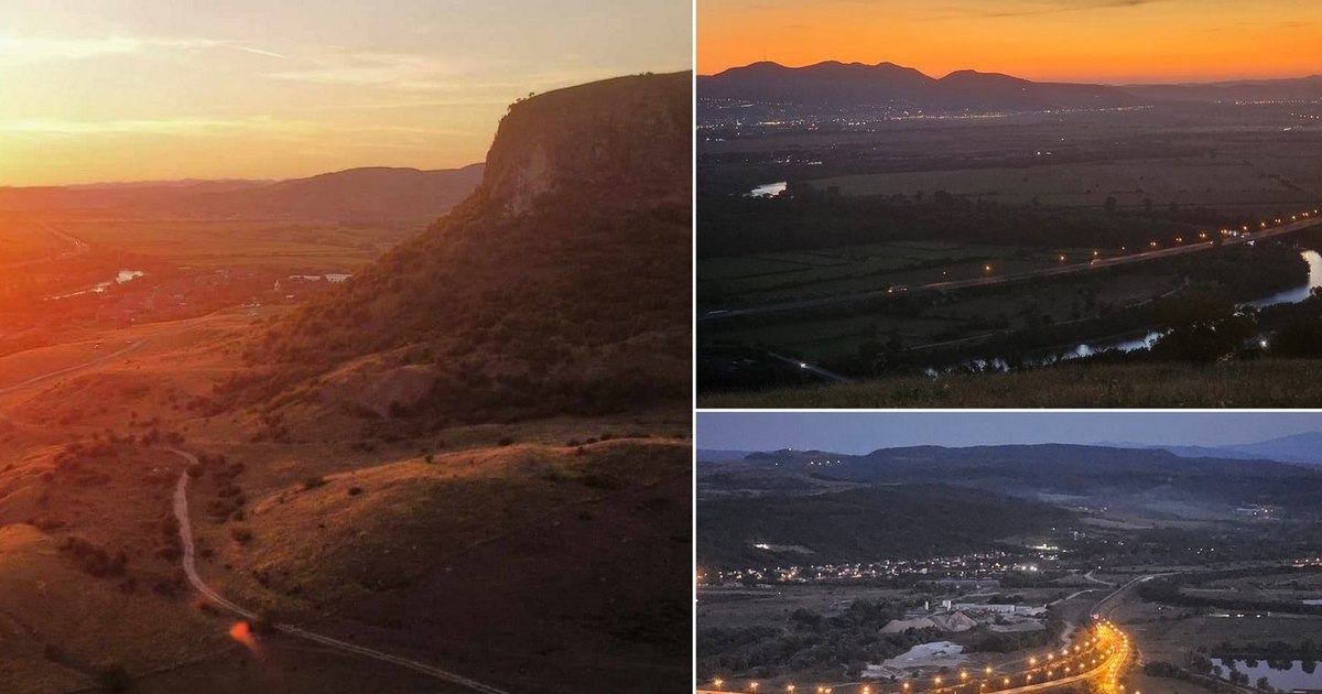
The spectacular panorama, visible from Măgura Uroiului
From the right bank of Mureș, crossed by the Simeria – Geoagiu road, travelers who want to reach Măgura Uroiului (video), climb here on a dirt road that skirts the hill to the left.
Once they reach the summit that rises over 200 meters above the Mureș river, bordered by steep trachyte walls, they are presented with the panorama of the Mureș valley, visible up to tens of kilometers away, to the right – towards Deva and the Poiana Ruscă and Metaliferi Mountains – and on the left – towards Orăștie, the Șureanu and Apuseni Mountains.
On clear days, tourists can see from Măgura Uroiului, looking ahead towards the valleys of Cernei and Streiului, Hunedoara, and on the horizon, the ridges of Retezatu. At the foot of the hill, the Mureș River flows forming rows of loops, which intersect with the routes of the A1 Motorway and the Alba Iulia – Deva – Arad railway.
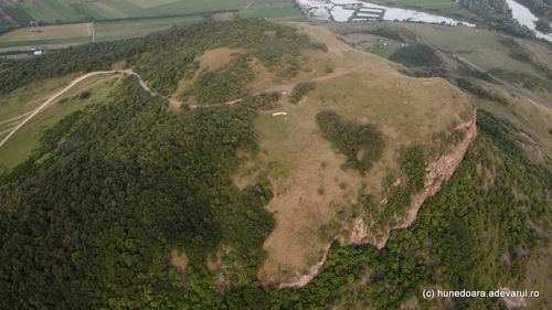
Image 1/12:
Magura Uroiului from Hunedoara Photo Daniel Guță THE TRUTH (16) JPG
Măgura Uroiului, with an area of ten hectares, was declared a geological nature reserve, a Natura 2000 site.
“Located on the territory of the city of Simeria and the commune of Rapoltu Mare, Măgura Uroiului is made up of quartz andesites accompanied by explosive columns of breccias, being the result of neogene volcanic activity. As a product of the subsequent magmatism, the andesite basket of Magura was formed, from which the subsequent erosion removed a large part of the superstructure of the volcanic apparatus. Geological and petrographic studies have shown that after the destruction of the volcanic apparatus only the very characteristic filling brought up to date on the slope from the Mureș valley was preserved“, pointed out the Hunedoara Environmental Protection Agency.
Several rare plants, such as the foxtail, the mouse tail, the yellow acacia, the cuckoo’s sedge, the field sage and the field pine, but also the presence of horned vipers and several species of birds added to the charm of the place.
The stone quarry from Măgura Uroiului
At the foot of Măguria Uroiului, the remains of a Daco-Roman settlement were discovered, indicated as the ancient Petris (Petrae) mentioned on the Tabula Peutingeriana – one of the known maps of the Roman Empire.
“For the Roman era, Măgura Uroiului was one of the most important sources of stone extraction in Dacia Province. The superior quality of the volcanic rock, the pleasant appearance and color, but also the location of the source at a relatively short distance from the great center of stone quarries in Micia, made Uroi andesite widely used both as a construction material and as raw material in the elaboration of sculptural monuments or inscriptions”, pointed out archaeologists Marius Gheorghe Barbu, Ioan Alexandru Bărbat in the work “New archaeological information regarding the exploitation of andesite at Măgura Uroiului (Hunedoara county)”.
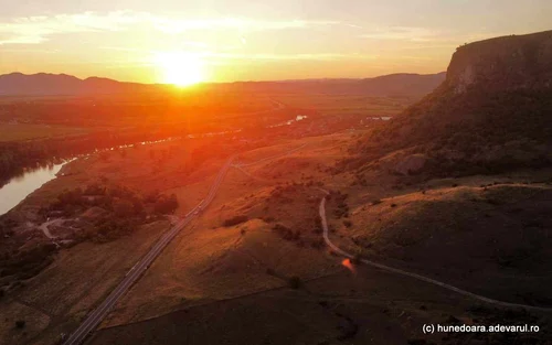
Image 1/9:
Magura Uroiului from Hunedoara Photo Daniel Guță THE TRUTH (2) jpg
The remains of the working fronts and terraces of the ancient stone quarry, facing the Mureș River, are still visible today, as well as the walls of a ruined medieval fortress, built of local material, at the foot of the hill of andesitic and trachyte rocks.
The rocks from the Uroi quarry were used for construction in the Roman settlements in the Mures valley, especially in Micia, the pagus (ancient rural locality) located on the western borders of the province of Roman Dacia, defended by a fort with over 500 military.
In the Middle Ages and in the modern era, the quarries at Măgura Uroiului continued to be exploited, and the volcanic rocks were used for the construction of the medieval fortress and for the construction of churches and noble mansions in the surroundings.
Several important archaeological discoveries date from the 19th century, in the area at the foot of Măguria Uroiului, crossed in ancient times by the imperial road that connected Ulpia Traiana Sarmizegetusa with the mining centers of the Apuseni Mountains.