

The curriculum for the optional “GIS Hour” was approved and published in the Official Gazette, the Ministry of Education and Research announced on Tuesday.
The discipline is at the intersection of Geography and Information and Communication Technology, but it also opens learning to the environment, urban planning, transport, tourism, heritage protection, risk management, sustainability, local economy and digital citizenship.
The optional is addressed to high school students, 9th – 12th grades, theoretical stream, real and humanist profiles, all specializations.
The duration of the optional is one hour per week, for the duration of one school year.
“The GIS class – the elective where the map becomes a laboratory, the phone becomes an exploration tool, and community data becomes the starting point for solutions is a discipline for students who want to learn hands-on, work with technology and better understand the space they live in.” states the cited source.
GIS stands for “Geographic Information Systems”, a technology used to collect, analyze and interpret data associated with geographic locations.
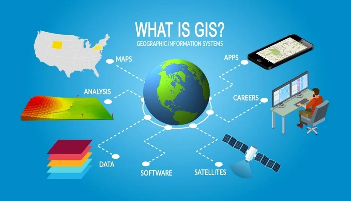
Basically, GIS is the basis of applications and services used daily by millions of people, from Google Maps and Waze to systems used for city planning, traffic management, environmental monitoring, agriculture, emergency response or infrastructure development.